- Details
- Written by Super User
- Category: Blog
- Hits: 53038
SOUTHERN LESOTHO MARCH 2016 – THE LAND OF THE SILHOUETTE PEOPLE
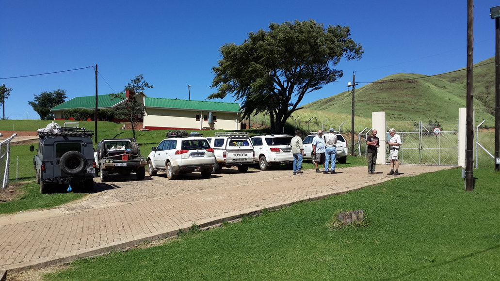
7:30 am at the Hilton Rotunda saw the gathering and departure of a convoy of 5 vehicles, to Matatiele our first stop. Sgt Major Steve patrolled the ranks encouraging us to check our radios before leaving ! This first leg was an easy non-eventful ride with the usual banter on the radios. At Swartberg we took the short-cut dirt road to Matat, where we made radio contact with and were joined by the Suzuki Vitara driven by Carol and the venerable vintage Landrover, from Bishopstowe owned by Johan and Jean. Everyone was in high spirits when we refuelled and purchased last minute requirements. With the weather fine, we set off towards the Ongeluksnek Border Control post along a dirt road not far outside of Matatiele. Immediately noticeable was the colourful cosmos on either side of the road and numerous beautiful old sandstone homesteads from a bygone era. At one stage Carol appeared to be losing a piece of her Suzuki, which required some leopard crawling to retrieve it from under the vehicle!
In a short while we reached the border control post in the Southern Maluti mountains. We were pleasantly surprised and impressed at the cleanliness and efficiency which we experienced there. We were directed to proceed through two large gates, beyond which no clear road was visible.

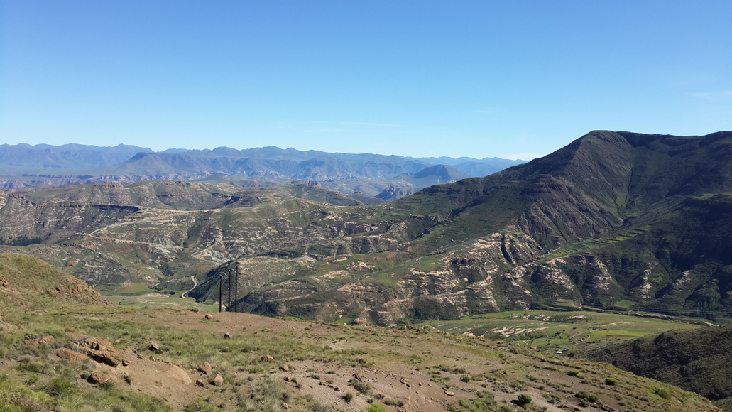
However our fearless leader Ronnie proceeded on and in a short while we picked up the Ongeluksnek Pass track. We were particularly struck by the luminous green colour of the surrounding grasslands reaching up the flanks of the mountains.

The track quickly steepened and deteriorated to a grade 3 off-road situation. Low range was selected and those who needed lock hubs, did so. Although the going was slow, consisting of crossing numerous deep ruts and steep sections, we all proceeded successfully to the top of the pass, with a few stops along the way to admire the views.
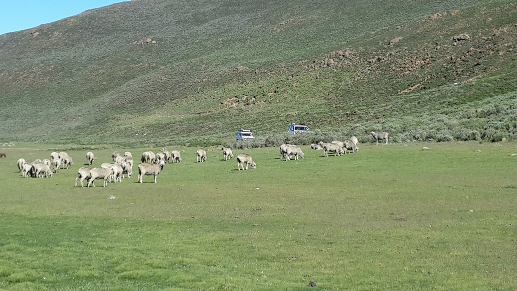
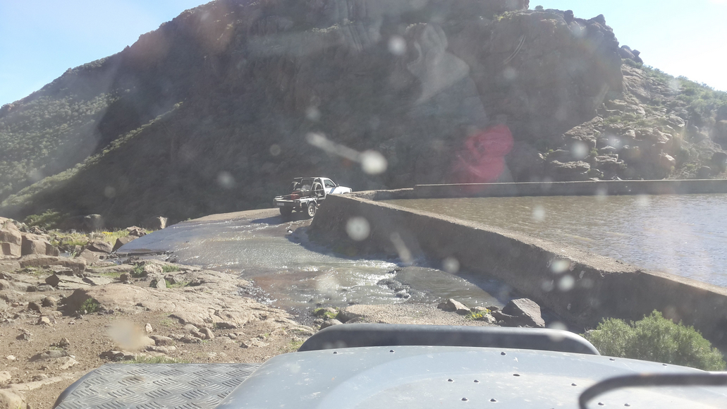
On reaching the top we were greeted by a broad, expansive catchment area covered in short green grass with numerous flocks of sheep and angora goats. We noticed the first few Basutho shepherds in their traditional blankets and got to see their small sandstone shelters and kraals which protect them from the sometimes harsh elements. We then stopped for a short late lunch-break on the grassy banks of a man-made reservoir, in an area called Maphooaneng. Vehicles were checked and adjustments carried out as necessary and once completed we headed on and down into the river valley, following the Quithing River. Some members of the party who were dithering a tad, were almost left behind. It took a while to realise that we were in fact participating in the Roof of Africa Rally and luckily the ever patient Heather and Richard, were able sweepers and brought the stragglers into line! With the sun sliding towards the mountain tops we needed to find a suitable camping spot for the night.

After proceeding through numerous villages, thanks to our intrepid map readers Gary and Ronnie, assisted by Steve we came upon a sheltered area on the banks of the river. Tents were set up, a fire was lit and we all relaxed into the evening, enjoying the sound of the river nearby. Unusual for this part of the world, the weather was mild and dry. Looking up at the towering mountains surrounding us we noticed the presence of the silhouette people, outlined against the evening sky, the young shepherds gazing down on us inquisitively. A good start to our trip.
Refreshed after a good sleep, we were all up early on Sunday, packed and ready for the next leg. Before departing, the Landie required some clutch fluid and after a small tussle with a steep bank, we got back onto the road and continued in convoy. One of the Hiluxes appeared to be leaking ATF fluid from the power steering unit and it was decided to continue to Mount Moorosi to source some fluid and to refuel. Luckily despite it being Sunday, Ronnie and Gary managed to procure a few bottles of fluid and we were able to top off our fuel tanks. The intention for the day was to route towards Qachas Nek and then on to the bottom of the Matebeng Pass where we would camp for the night before tackling the pass the following day. On leaving Mount Moorosi, our convoy drove along the Senqu River towards Mphaki.
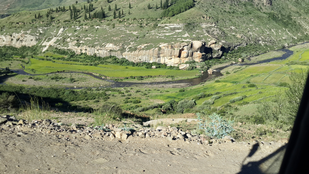
We started climbing out of the river valley, crossing numerous rivers and enjoyed amazing views across Southern Lesotho looking back towards the West. It was evident in this area that much road building was underway with lots of bridge construction and road repair visible.


The convoy climbed continuously to the top of the Khamokha escarpment and we were now on a fairly good tar road (thanks to the Chinese) and were able to admire colourful swaths of cosmos in bloom in the fields.


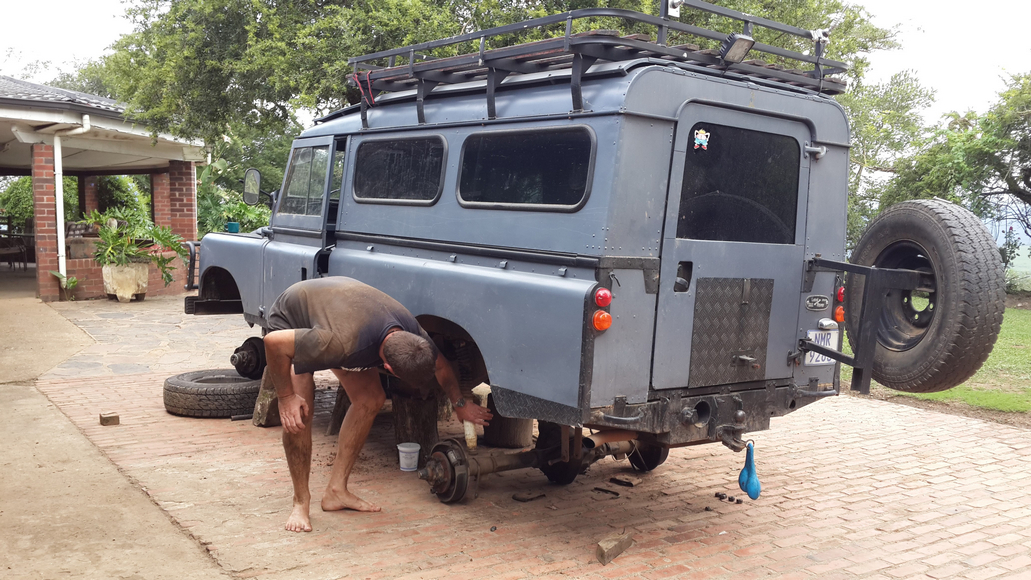
It was apparent that many of the locals were off to church as most people greeted us in their Sunday best. It was pleasing to experience the spontaneous friendliness of the local people. The children characteristically were excited to see and ever hopeful for sweetie handouts – which is something that is generally discouraged. Listening to radio comms it was apparent that the Landie was starting to experience serious clutch issues and it was decided to continue to Qachas Nek, to hopefully obtain a spare slave-cylinder kit. After receiving some directions from the locals, we located an open road-side spares outlet and Darryl was able to match a Toyota slave-cylinder seal with that of the Landrover. Optimistically we then set off for Matebeng Pass, however this was short-lived as the mechanical problem persisted. A last-ditch attempt was made to rectify the problem before Johan took the decision to return home via Qachas Nek, due to the rough terrain ahead.
With Ronnie and Gary still topping up the Hilux’s power steering fluid at regular intervals, we set off towards the Mathebeng Pass, hoping to reach Phillip’s camp, at the base of the pass, before nightfall. Back on dirt road, we were still travelling parallel to the Senqu river way down in the valley. At this stage the sun was starting to set and we were delighted to see the well shaded, lovely camp site ahead and below us. Phillip’s camp consists of a large, flat, well-shaded and grassed area right on the banks of the Matebeng river. We once again enjoyed mild, even warm weather, with no wind and some of us revelled in a refreshing bath in the fast-flowing river. The campsite is secure and equipped with a clean, long-drop toilet which the ladies enjoyed. After setting up camp, a fire was quickly lit and a pleasant social evening was enjoyed by all as we ate supper and chatted.


The morning brought another perfect day and after breakfast, Darryl assisted some locals who brought a broken generator for him to repair. We were also fortunate to locate some high pressure hose from someone’s toolbox and so were able to properly repair the Hilux’s leaky steering.
We then set off up the Matebeng Pass – headed for Ramatseliso’s Gate. The track rapidly deteriorated to grade 3 with numerous rocks and eroded channels on the road. We passed many quaint, remote villages that had been built out of the natural stone.

The countryside became more and more spectacular as the road wound its way, with many switchbacks, to the escarpment. We paused for a viewstop at the summit, before continuing down the Eastern side of the escarpment descending towards Sehlabathebe.


Here we saw a number of locals collecting the abundantly available short, coarse bushes which they use for firewood and heating. We also passed a stone-mason’s site and could see how they shape sandstone into building blocks, which seems to be a dying art. At the base of the Matebeng Pass we stopped for lunch. Some less fortunate people, were made to cook bacon and eggs !
With our tummies full, Ronnie lead us down the bank, through the river and onwards to Ramatseliso’s Gate where border control formalities were concluded without incident.


After getting back into SA we followed a short-cut to the Swartberg road. This turned out to be a rough, slow trip but we finally reached the Swartberg / Underberg road. Here we bade farewell to Carol, and with rain-threatening we continued on the final leg towards Underberg and on to Pietermaritzburg. Mention must be made of the encouragement and support offered by Ronnie and others to Carol, who travelled alone, and excelled at handling the sometimes challenging conditions, and also thanks and appreciation to Ronnie, Gary, Steve and Richard for their valuable input and care throughout the journey !!
- Details
- Written by Jeanne Schutte
- Category: Blog
- Hits: 41453
We started out on a crisp Saturday morning (due to the age of our vehicle and its ‘reliable’ reputation) Johan had decided it was better we go ahead of the pack so that we did not hold up the others and meet on time in Matatiele. We left at 5.30 and started out on the four hour journey breaking, for coffee in Underberg and then onto our final destination where we would all meet. We arrived in good time and our old trusty Land rover did not give a moments trouble giving us time to meet with another early adventurer, Caroline, in her Suzuki. While we waited, we sat eating ice cream on a service stations tarmac driveway chatting about the weekend ahead.
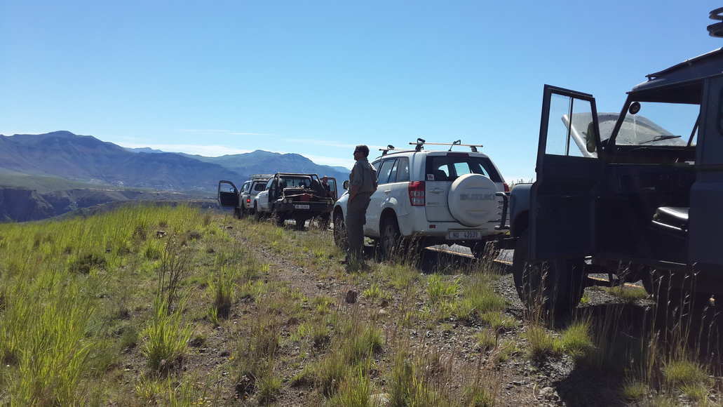
The other drivers arrived in due course, four Toyotas (various shapes and sizes) a Mitsubishi and our Land Rover made up the balance of the group. 12 people and 7 vehicles in total.
Ronnie took us rookies under his wing and we joined the convoy heading up to Ongeluksnek Pass border post. I was told later that day it was named after some Griquas in the 1860’s going to settle in Kokstad, apparently an ox wagon had crashed on the pass leaving a person dead.. That was where the name had come from - a scary thought for me with little to no 4 x 4 experience. I was also pleased to hear that a landrover had been the first vehicle up the pass driven by Lionel Whittle in the early 1950’s.
My first impression of the group was daunting, it appeared to be made up of 4 x 4 veteran enthusiasts with lots of knowledge. On arrival at the Ongeluksnek pass I was forced to doubt our mental state of health before we had even started when the gatekeeper asked us, with a worried expression on his face, if we were sure we were going up the pass in our vehicles.
At the border post our passports were checked we were on our way.
With the wheels locked and the vehicles put into low range we started up this dodgy dirt track that did not look like it had seen a motor vehicle of any kind for quite some time.
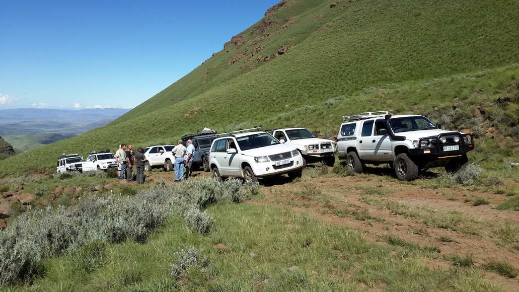
We wound our way up the pass climbing over boulders and rocks that had me more than a little worried on many occasions.
Around the corners and up we went to the top of the pass, thankfully with no major hiccups. The gradient I was told is 1:9 average gradient, with a maximum gradient of 1:3. Leading to an interesting debate regarding the possible tarring of Sani Pass versus Ongeluksnek Pass.
The group of us stopped for lunch at the top of the pass near a large alpine lake, Lake Letsie surrounded by horses, sheep and donkeys grazing on the rich green grass. There bells softly clanging in the distance.
The crisp wind reminded me we were in Lesotho and I wondered how people survived in the winter months if this was early Autumn and everyone we had seen so far were already layered in blankets.
After a quick lunch we were almost on the road again but a leak was noticed in Ronnie’s Toyota. It was fluid from the power steering and this lead to a hunt for fluid on the route as we wound our way through the winding passes alongside rivers and canyons.
We did not quite make Mount Maroosi for our evening stop but found a lovely campsite at the base of Devils Staircase alongside a small mountain river. Camp was quickly set up and braai fires lit with allot of chatter around the fire side and an early night was had by all.
I awoke to bird calls and after a quick cup of tea we were packing up and warming the vehicles. Our lovely campsite was christened Jabu’s campsite.
Unfortunately that was the beginning of the end for us, Johan put his foot on the clutch and discovered we had none. After all the friendly bantering about Land Rovers the night before our Landi had taken some offence and decided to live up to the reputation.
Thankfully our new friends were there with good humor and a very kind Daryl clambered under the Landi to help Johan bleed the clutch.
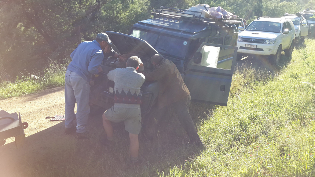
Our troubles did not end there.. the Landi decided to remind everyone there was a “Land Rover” in the group and gave trouble a second time just moments after leaving. With lots of helpful advice and Daryl coming back to our rescue we finally got the show on the road.
The group headed into Mount Moorosi to get some brake fluid for us and Power steering fluid for the Toyota. Those that needed to fill up at a petrol station were pleased to find out that the diesel price a mere R8.40 per liter. We then headed up the road to our next destination.
The winding mountain passes and super steep hills lead to our undoing, the clutch decided it was not going to cooperate and after being filled and bled countless times the brake still fluid ran straight through. It was decided to try look for a spare at Quacha’s Nek to try keep the Landi on the road and find a little more fluid for the Toyota.
With great excitement we found a spare and Daryl for the 5th or 6th time that day came to our rescue. He replaced the faulty clutch slave surrounded by all the “nurses” he got stuck in and made the repairs. The patience and the kindness of the group was so appreciated as we are very new to the club, the good natured banter (normally not in our Landi’s favor), support and ‘never give up’ attitude was so appreciated.
Unfortunately for us our Landi did not want to play the game and despite the fix the clutch just did not feel right. We made the decision to limp home clutch free as our van would not be able to carry on through the challenging 4 x 4 pass we were heading towards the following day.
We said our good byes and headed out via Quachas Nek, using our ‘crash’ gears we headed home.
Lessons learned: “tow a spare Land Rover for spares.”
Thanks for an awesome adventure everyone, repairs and more maintenance have been started in preparation for the next trip.
- Details
- Written by Jeremy Farquharson
- Category: Blog
- Hits: 95034
by Jeremy Farquharson
Summary: A trip undertaken in Sept 2015 to Ithala Game Reserve; single vehicle, 3 different routes; two free, one paid for.
Ithala is a magic place to visit or stay at, irrespective of whether or not you are doing any 4x4 driving there. It has 4 of the Big Five, the missing one being lion. We spotted 3 of the 5, with only leopard being elusive as usual. One of the best hutted camps around, and some great campsites and bush lodges as well.
There are actually four 4x4 routes within the reserve, with the longest and likely most demanding route being available only to people occupying the Mhlangeni bush camp. The remaining three routes are open to all, though the Bivane Trail has to be pre-booked (R75 per car), and can accommodate a maximum of seven cars per day.
A: Bivane Trail: (Grade 2 with some Grade 3 bits - trail could be tricky in the wet)
Bivane 4x4 is the longest of the 3 "public" trails, being approx 8km in length, and is found in the NW corner of the Ithala reserve. You'll need low range and high clearance for this one. It's an "out and back" route, where you drive the same track in both directions. It's almost exclusively single-vehicle width, so you need to keep a constant lookout for vehicles coming in the opposite direction. There are several sections that would involve a fair bit of very tricky reversing for one or other of the vehicles. Ithala management do not apply their own policy about which vehicle has to give way - simply deal with it as and when it arises, and move the vehicle which can most simply get off the trail.
The route crosses a rocky stream bed right at the start, then winds and climbs for several km up a rocky, tree-covered hillside. The trees and bush are quite dense, so getting off the track is often difficult. Most of the climb is a rough gravel track with a middelmannetjie, and a hard substrate covered with loose rocks and pebbles. However, there are several steep sections with rock steps, though most of the steps are not very large. Some parts of the track involve tight climbing turns with bush encroaching tightly on both sides, as well as loose rocks. In dry conditions, these climbs and steps are fairly easy, but a wet trail may be a different proposition.
The trail climbs to a grassy nek, where a short section (200m) drops from a T-junction down to the right to a turning circle. Park there and walk to the top of a nearby koppie for 360 degree views of the Pongola River valley below. Retrace your steps, then turn right (downhill) at the junction. The track drops steeply down to the right over loose, rocky terrain, with big drop-offs to your left - no mistakes here, please. You'll eventually reach a flat open plain running next to the Pongola River itself. Great for a picnic, but stay clear of the river - crocs live here! Return via the same route. Remember to stop where views allow, to check for oncoming vehicles.
B: Dlabe Trail: (Grade 1-2)
This is a 4.1 km trail that joins two ends of the Ngubhu loop road which skirts below the cliff-line running along the SW and southern borders of the park. Very simple driving - pretty much a gravel road. Emerges near the Doornkraal campsite and Thalu Bush Camp, and the start of the Bivane 4x4 trail in the valley. In dry conditions, this could be done easily with a high-clearance 4x2.
C: Ntshamanzi Trail: (Grade 2 with one or two short grade 3 sections)
Much more fun! Quite rough in places, has a hard substrate, and lots of lovely loose gravelly / rocky stuff to clamber over. A number of short drops / climbs have quite large loose stones / small rocks to negotiate. This track drops into a remote, interesting and heavily-treed valley. Lots of birdlife, and elephant sometimes spotted there. The route emerges onto the tar road leading down to the Pongola River - (the Dakaneni loop.)
D: NceNce trail: (Grade unknown to me as I did not drive it, but apparently Grade 3-ish)
This one is available only to clients who have hired the Mhlangeni Bush Camp. About 23km in length and apparently tricky in some places. An Ithala guide is a compulsory passenger for this trail. Call Ithala Camp (034-983 2540) for more info.
E: Horace Rall viewsite: (Easy drive, though H4 is useful once on top in the grassland)
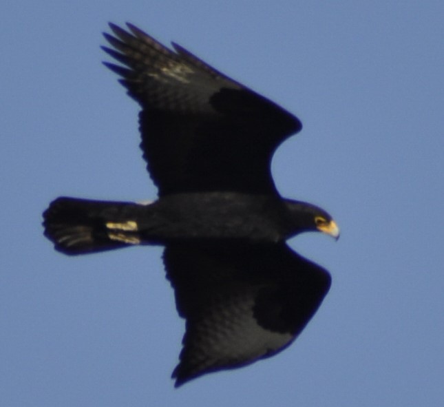
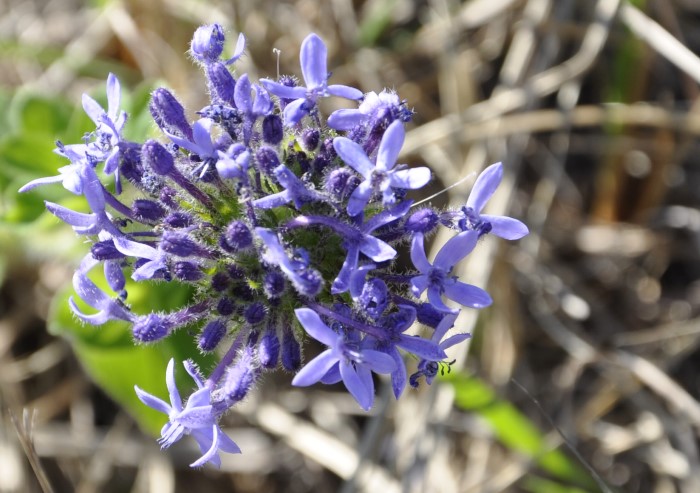
This drive is a MUST-DO!! Fetch the key for the access gate from Ntshondwe Camp reception. Drive out of the Ithala reserve, back up to Louwsburg village. At the 4-way stop on the main street in the village drive straight across and up the hill onto a concrete road built by the military in the 70s. Near the crest of the hill, turn right through a gated entry point (with no gate!!) The road doubles back on itself towards Louwsburg, but now runs along the crest of the mountain. About 2km later, once through the locked gate near the old comms station, you must close and lock the gate behind you. About 200m into the fenced area, turn right onto a grassy track near a copse of wattle trees, which takes you rightwards and up a low slope to the cliff-top view-site. The viewing platform offers incredible views across the entire reserve. We saw a pair of Black Eagle and a Jackal Buzzard close-up within 3 mins of our arrival at the viewsite. Also unusual / rare plant species - mostly montane belt species including beautiful wild flowers and succulents. You may come across a very rare kind of aloe - Aloe Vryheidii (ask Alan Smale, the camp manager, to show you these outside the reception area at Ntshondwe Camp) as well as a unique protea tree with yellow blooms. Don't miss this drive. - it's a fantastic 1.5 hour trip if in a hurry, and a place to linger and walk in for hours if time permits. Camera and binocs are compulsory. Don't forget to drop the key at reception once back in camp.
The "Budgie" is a bit blurry thanks to rapid flight, but....
- Details
- Written by Super User
- Category: Blog
- Hits: 49453
4x4 Club Midlands Tour to the Battlefields 7 – 10 August 2015 (by Ruth Varrie)
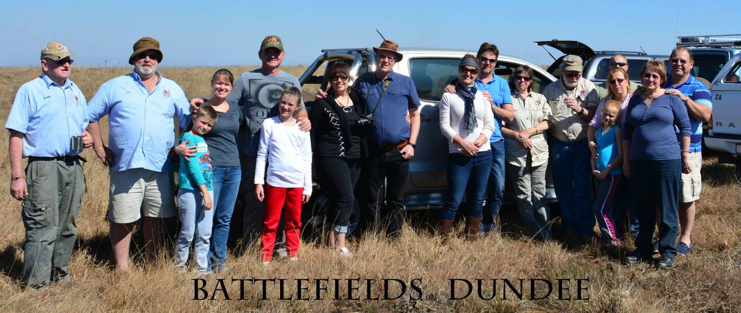
On the long weekend of August, 7 members and their families set up camp at the lovely little Kwa Rie caravan park in Dundee. The park is privately owned and run and the pleasant surroundings of a little dam, well-kept gardens, grassed sites and excellent ablutions boded well for a very enjoyable weekend. The men in our group lit a lovely big braai fire and while it was smouldering contentedly our Tour Guide for the weekend, Mr Anthony Coleman joined us at the camp and spent a very interesting 45 minutes Getting to know a bit about us and giving us some of the history around the battlefields we would be visiting the next day.
On Saturday we left in convoy at 08h00 and travelled to Hlobane, about 80 km from Dundee. Anthony grew up in this area and knows it like the back of his hand which made the trip all the more interesting. He pointed out trains that transport coal which are arguably the longest in the world, sometimes up to almost a kilometre long!
Along the way we stopped on the side of the road to have a look at a big map of the area that Anthony had brought with him as a visual guide of the battle, and to orient us about the events that took place on 28th March 1879. Our drive to the bottom of the hill took past the redundant coal mine which was the biggest in the world in its day. Anthony also pointed out a little house where he spent some of his childhood next to the mine, still occupied and sadly painted a bright toffee pink, unbefitting of the historical age of the place!
We commenced the ascent of the hill, driving up to the flat top of Hlobane Hill. This required some engaging of low 4 gears and negotiating of soft sand and rocks. The Kiepersol (Cabbage) trees that grow on this mountain were plentiful and Anthony told us of a little known fact – The trees are protected and were almost wiped out by the Voortrekkers who loved to use the soft wood as “brake pads” for their Wagons! There is one old Kiepersol tree there that has a little bench under its branches and Anthony recons it must be around a hundred or so years old as it is by far the largest he has seen. We stopped about half way up to view the graves of Campbell and Lloyd who were killed whilst observing the action, with Colonel Evelyn Wood.
After travelling about 15km along the top of the flat-top mountain, passing a stone wall built by the Zulus about 500 years ago, we reached the spot where the Battle of Hlobane took place. Our drive along the top followed the route of the retreating British and Colonials and then stopped at the Devils Pass, where the frantic men British soldiers, cornered and outnumbered by the Zulus, at about 1000:1 literally tumbled down the hill with their horses. The views over the cliffs into the valley below were breath-taking and one could feel for the Brits, who with no escape would rather commit suicide by jumping down the cliffs than face the slaughter that was inevitable by the Zulu Army.
On descent we stopped at the site where a group of Colonials had tried to escape, only to be faced with a barrier of cliffs. Here another contingent of British Soldiers, including a Colonel who was travelling with his cerebral palsied 14 year old son, were cornered by the Zulus and literally thrown off the cliffs to their death. We decided to stop for half an hour and have a picnic lunch. This made the local security very nervous and they quickly arrived to find out what we were doing and to warn us not to start any fires.
The next stop was at Kambula, where the British force held off a determined Zulu attack on 29th March. Anthony covered the battle and we visited the British cemetery before returning to Dundee camp for a nice social braai.
On Sunday we followed Anthony on a trip into the rural areas to the South and South East of Dundee, an area seldom visited . We stopped to view some rock art which includes the only known rock paintings that are done in blue! Then made our slow way along some fairly challenging 4x4 routes down to the Buffalo River where we had lunch under the trees before visiting Msinga Top for a view of the confluence of the Buffalo and Tugela Rivers. I must say at this point that the views and the aloes in that area are spectacular! Ronnie and Gary flippantly dismissed the roads we were driving on as “Grade 1” but later did admit that in some places they could have been “Grade 2”. To those of us who are much less experienced than the “Ballies” it was pretty scary and I rate those routes as a novices “Grade 4” at the very least! I know this will make some of you smile and think “sissies” but remember when you started….. We were all beginners once! Dave and Kotie had some fun trying to find a place where Kotie could buy her beer and finally found a trading store that had just what she was looking for in quarts just under the counter and at much less than one would pay in normal bottle stores.
After some interesting driving to avoid goats, cattle and “merry men” wending their way home after Sunday celebrations, we arrived back in camp in time to watch the rugby and do some celebrating of our own. After a lovely braai, Jacque fetched some marshmallows and wooden skewers and John Buyers taught us the proper way to toast them over the fire.
On Monday we woke up to overcast and cool weather to send us on our way back to Maritzburough after a wonderful weekend of making new friends some with some of the most well behaved children ever, gorgeous weather, interesting education and a spot of 4x4ing. All in all a most enjoyable time and I am glad I didn’t miss it!
- Details
- Written by Super User
- Category: Blog
- Hits: 38945
Exploring The Wild Coast 25 April - 3 May 2015
An eagerly awaited journey lies ahead of us, one that will leave us captivated in awe from the amazing scenery that is yet to be discovered…
Our team included: Ronnie & Cathy Drew, Steve & Maria Swanepoel, Ken & Maggie Peckham, Murray & Barbara Cowell, Anthony & Carol Morris, Gary & Debbie Buitendach, Lisa Coleman & Rory Neilson.
Day 1: Sat 25th April 2015 As the trip starts, we all met up at a bright & early 6am at Southgate Mall in Pietermaritzburg. Comparing our vehicles with regards to how much we packed & how it fitted in, from the small to the bigger vehicles…it's amazing what all you can fit in a vehicle when space is limited… We were all packed & set ready to go on our 9 day adventure. It was a long day of driving, travelling down to our first stop at Morgan's Bay, about 600km. We had the odd stop along the way, including our last refreshing ice-cream stop We reached our campsite at Morgan's Bay Hotel & Camping at about 4pm. A nice campsite right by the lagoon leading into the sea, lovely view. We set up camp & had a braai that night.
Day 2: Sun 26th April 2015 We woke up to a few Pied Kingfishers at the water's edge, right by our tents, then a few Crowned Hornbills also came very close, looking for left over food scraps. After we packed everything up, Rory & I went for a quick walk to look at the ocean, lovely rock pools & the start of some cliff edges at one end.
All set to go, we headed off at about 9am to our next destination. After the odd stop (including one to see an aeroplane called 'Eish Airlines' at the side of the road), we reached the Ferry Crossing at about 10am & crossed the Kei River by the mouth. The ferry only took 2 vehicles at a time but the crossing was a lot quicker than we expected.
Once we were all over onto the other side, we continued & now things started to change…4 wheel engaged & soon low range…now the fun began… The road went from dirt to grass to non-existent at times. We had the odd river crossing & muddy patches. We reached quite a rocky section going uphill which was rather interesting, a bit of a bumpy slipping & sliding task for some of us whilst others just cruised up & over. The amazing part was when Ant got a bit stuck & while the guys were helping him out we noticed a large tray of eggs lying perfectly on the back seat - not one was damaged on that bumpy terrain! Soon thereafter we were driving among the hills & started seeing the ocean in front of us, such beauty… We stopped for a bit of lunch, then reached Trennery's Hotel at about 13h30.
Still early in the day, so a few of us decided to carry on & visit the 1971 Jacaranda Shipwreck nearby. Lovely rocky beach, but sadly didn't see much of the ship remains, they say it's disappearing more rapidly & not much will be left to see one of these days.
As we drove around, the off road tracks took us through the odd marshy bit along the way & unfortunately one patch caught most of us, it was a much eroded steep incline, between soft sand & mud… So after a few tries, it was getting late, so brought out the tow rope…
Then got back to Trennery's about 5pm or so, a bit later than expected as our 'quick drive' turned into quite a scenic 4x4 route. We all set up camp for the night & made a braai again for dinner.
Day 3: Mon 27th April 2015 After packing up, a few of us walked down to get a glimpse of the beach next to the campsite before leaving. Beautiful views of lovely rocks pools & sand dunes next to the lagoon. Soon after 9am we head off for our next long bumpy drive to Dwesa Nature Reserve. We aimed for the short cut 4x4 route marked on the map, stopping for lunch on the way at Manubi Reserve near Mazeppa Bay - which had a trail walk to a 'big tree'. We eventually reached the 4x4 road which wasn't very visible. Steve attempted it first to see what it was like, but after a very steep decline & very rough part, he decided it wouldn’t be safe enough, battling to turn around to come back. So unfortunately we had to go back to the main road (which was still dirt though) & continue the roundabout way. We were a bit relieved to see a sign saying Dwesa was 47km away, but little did we know how long that was going to take us due to the road conditions… We started to see the sea again which was a good sight & eventually reached the Reserve around 16h30. A slightly different campsite to the rest, it was more rustic, limited ablutions & without electricity. I think everyone was a bit tired that night so we didn't braai.
Day 4: Tues 28th April 2015 We spent 2 nights at Dwesa, so it was nice to have a more relaxed morning & not have to pack everything up again. Most of us went for a casual drive around the Park to Dwesa Point & then we walked to find the O' Bell Shipwreck from 1916. Driving in the Park was very forestry, it was beautiful. Then we reached the green rolling hills alongside the ocean, such beauty. We stopped at one point & walked out along the rocks, instead of sand it was covered in tons of seashells, so we collected a few nice ones. We drove a bit closer to get to the shipwreck. A few of us walked down to the beach & out to the edge to look for the ship remains but unfortunately we didn't see much, but it could have been high tide when we went. There were some whale bones on the side of the bank which was interesting to see.
Back to the campsite, we had a few annoying monkeys around our tents… Took a walk to the beach near our campsite & saw 2 Black Oystercatchers on the rocks. Made the braai earlier this evening due to the limited light.
Day 5: Wed 29th April 2015 After 9am we left Dwesa & headed to our next campsite for 2 nights at Coffee Bay. We stopped along to the way to see a stone monument placed at the side of the road in memory of Dick King. We reached Coffee Bay at about 14h30. Nice little campsite with slightly more secluded but shady spots. But we camped as close together as we could. After putting up tents & having some lunch, Steve, Maria, Gary, Rory & I walked over to the beach, crossed the lagoon mouth & walked along the ‘main street’ to check the area out a bit. It has quite a rustic, hippy-like, laid back type of feel to it, I saw it being referred to as a place to indulge in some 'giggly twig' at times with drum circles & full moon parties. We were offered 'shrooms' a few times, ha ha  But also known for things like good surfing, hiking trails & amazing scenery. That evening we could hear the bongo drums going in the near distance.
Day 6: Thurs 30th April 2015 A more relaxed morning, we took a drive to explore the beautiful area around us. We headed on to Hole in the Wall, the ever famous site to see if you're ever in Coffee Bay, only about 9km from the campsite. The road seems to have deteriorated a bit over the years, but you can still make it in a regular car with careful driving dodging potholes & eroded paths. Looking for a place to park, when we stopped we suddenly got hounded by many locals either wanting to look after the cars or be a guide to the Wall. But we decided to rather drive a bit further up the hill to find another spot instead. Then there we saw it - the beautiful view of the Hole in the Wall! What an amazing sight…
Steve, Anthony, Gary, Rory & I walked down the hill to get a closer view of the Hole in the Wall, amazing. Then Rory & I decided to venture up the Buttress next to it. Wow… It's hard to explain how captivated one can feel when standing in front of such a panorama. Standing in awe at the amazing beauty that surrounds you, it almost feels like you’re in a dream… It is times like that when you feel so small amongst God's creation.
It seemed like we could have stayed there for ages taking in the surroundings, but after taking tons of photos, we went back to the campsite for some lunch. Anthony however stayed there & walked along the path that runs next to the ocean back to Coffee Bay, which he really enjoyed.
Then Steve, Maria, Ronnie, Ken, Gary, Rory & I went for a drive to the Umtata Mouth. Another beautiful area, driving over the green hills at the ocean's edge to reach the mouth, where the lagoon winded around into the ocean. It was funny, we stopped at the bottom of this really steep hill & started walking around it, but Ronnie decided to be the first crazy one to drive up & over it instead, then the rest followed him on to the edge of the cliff. We headed back as the sun was starting to set for the day.
Day 7: Fri 1st May 2015 Once we packed up our tents we went to the beach to have one last look at it before we left, picked up a few smooth pebbles to remember it by. We took a drive back to Umtata Mouth to show the others that missed out on it the day before. It's amazing how quickly you get spotted by the locals when you stop somewhere you think is isolated. But they can be a bit of a pain because they tend to hang around & watch you as though they are watching a live performance, but it's worse when they always run at the side of the road as we drive past & shout 'sweets' to us, the odd kid attempts to throw a stone, but dashes like a lightening bolt if you stop after him. Some of the animals we pass along the road also don't so healthy & looked after unfortunately.
We headed onto our next destination for the night, The Pont at Port St John's. It felt a bit weird when we started hitting the tar road again after so long… We arrived there around 3pm, went through the town a bit to see it, but it was so jam packed as though it was market day. A few guys went into the Spar for a few items, then we drove to the end by the lagoon, what they call the Gate. Then off to the campsite to set up camp for the night by the river & braai. Bit of a noisy area though, not like some of the tranquil places we got used to.
Day 8: Sat 2nd May 2015 Packed up & headed off to Mboyti. We stopped off to see Magwa Falls on the way, a lovely high waterfall cascading over the edge of a cliff going into a beautiful gorge. Then we went to see Fraser Falls, this one was a bit further away in the distance on the other side of the gorge valley, but it was a beautiful area.
We reached Myboti early, around 1pm, so we had time to relax more whilst putting up tents & having lunch. A few of us wanted to explore more of this new area, so Steve, Maria, Ronnie, Ken, Ant, Gary, Rory & I went for a short drive up a few hills past the mouth, bit of 4x4'ing too…
Then Ant, Gary, Rory & I decided to walk back along the rolling green hills next to the rocky coastline.
It seemed like a short walk back, but it was worth the views climbing up rock faces & slippery grassy hills whilst the cattle just stood there gazing at us… It was a good end to top our journey off with
That night we all enjoyed our last braai together.
Day 9: Sun 3rd May 2015 Alas…our last day has come, it's nice to know we won't have to unpack the car & put the tent up again only to pack it back up the next morning, but it's sad to think that our 9 days of living in almost a dream has slowly come to an end & we will have to soon face reality & our daily regime once again…
We left at about 9am & made our way back to Pietermaritzburg, about 330km or so. The crew seemed to be slightly more tired now though as the radio commentary slowed down a bit. Ken & Maggie parted with us & headed on towards the Port Shepstone direction, then we stopped off at Kokstad for a quick bite & then continued on where we then parted with Ant & Carol, then slowly each one of us parted as we reached our homes near Pietermaritzburg.
Thus ends a great journey leaving us with some beautiful memories Thanks to Ronnie for organising the trip & Steve for assisting in the lead & everyone else who helped with everything, it was a great team & I'm sure we all had an awesome time!
By Lisa Coleman Dreamer Adventures